|
|
|
|
|
|
|
|
|
Colorado Trail MTB Bike Tour
Day 14 - Marshall Pass, Sargents Mesa to North Pass
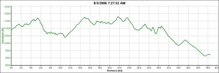
 August 3, 2006 - We packed up camp for the drive back up the dirt road to Marshall Pass. None of us wanted to ride the 11 miles back up to the trailhead, and for good reason. We'd planned to ride two segments of the Colorado Trail today, and knew we were in for a 35 mile day, most of which was between 11,000 and 12,000' elevation. The night had been cold, but dry. The lake was obviously a popular fishing spot, and the whole campsite was built around its edges. We were driving out by 7:15 in the morning.
Bill had decided to sit this one out, as he had to fly out the following morning from Colorado Springs, and didn't want to wear himself out. He was going to get a ride from Rooney at the day's end. It was a prudent decision on his part, as Bill wouldn't have enjoyed this section of trail at all.
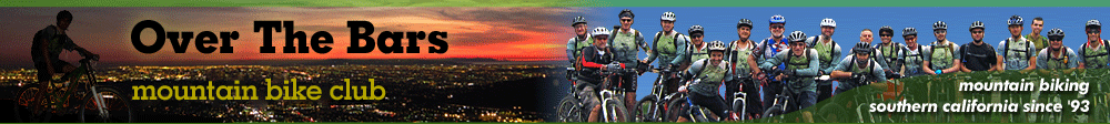
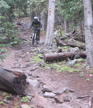
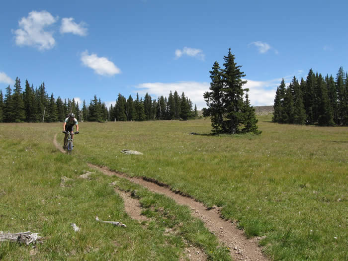
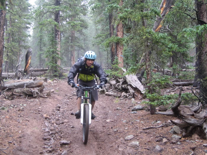
At the trailhead, the skies were already grey. As the trail leaves Marshall Pass it is a little confusing, coming across a five-way intersection. But we found our way and headed up the trail. It started out quite nicely, with a gentle climb, and good trail conditions. It continued like this for just a mile and a half, before merging with another trail that was open to motorbikes and quads. From here the trail was a little beaten up, but not too bad.
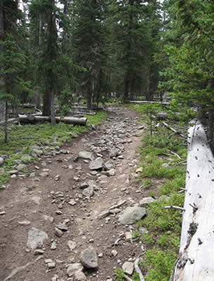
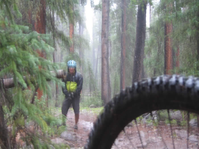
The trail climbed, descended, climbed and descended. There were no flat sections. It got increasingly rockier and rougher. Then it began to rain. The rain got steadily stronger and it began to hail. It rained for a good half hour as we plodded along the trail. The rocks became extremely slippery, and the clay between them very slippery. The trail itself became a stream of water, stripping out the dirt and coating the rocks in more slippery clay and mud.
Steve had a minor uphill crash when he spun out his back wheel on a rock and couldn't get unclipped in time, then when he did his foot slipped on a rock and he fell off the trail. Hans was up ahead finding cover under a tree. Ed plodded along and Rooney and Shawn were out in front.
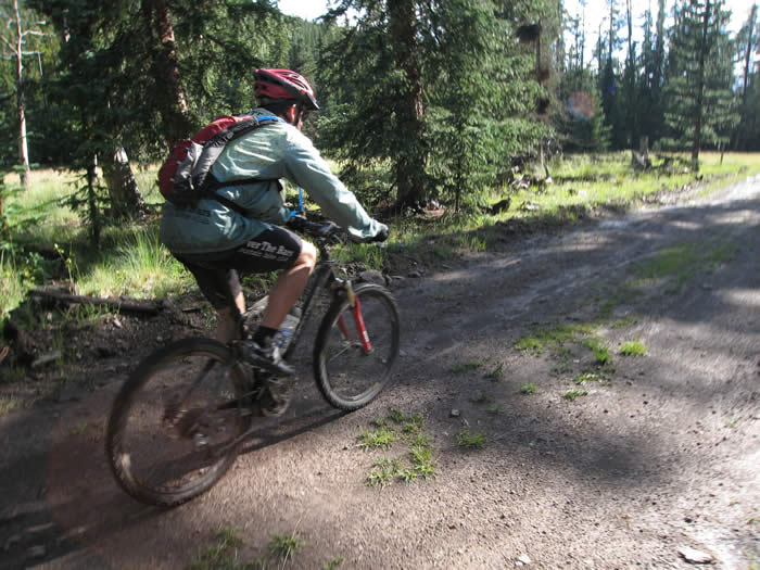
Eventually the rain eased, but everyone was soaked by this point. We were only about 4 miles into a 35 mile ride, and the prospect of riding another 6 hours or more in the rain was looming large in the back of everyone's mind. Hans' rain jacket had turned out not to be waterproof, Steve had brought the wrong camera (he had a waterproof camera as well as his regular Canon). Thus there were not many photos today.
At about mile 5, the trail descended for two miles. It was as much work to go down as it was going up.. the trail was now wet and extremely slippery, it was still drizzling rain, and we were all feeling the cold and wet. It took a good 20 minutes for the two-mile descent, which dropped 1,000'.
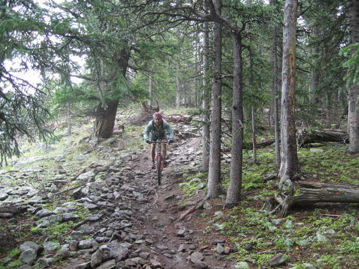
From here for the next 3 miles the trail became a series of short, steep climbs, many of which we hiked, and short, steep downhills, all of which were rocky, technical and slippery. It was rough going. Eventually there was a longer descent (half a mile) that dropped down to a creek crossing that didn't have a bridge.
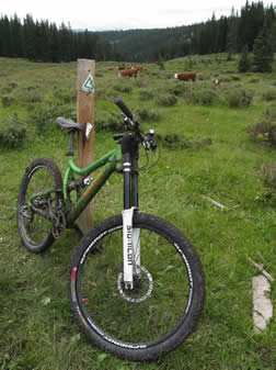
Shawn broke his chain at about mile 11, on the climb away from this creek. He and Hans spent a few minutes doing that repair. The trail after this point stood out in that it was a smooth, steady climb. It followed a creek up into a cow pasture, and became very narrow. There were cows that had to be shooed off the trail, and sloppy cow dung all over the trail.
The trail was extremely muddy and slipppery. Our tires loaded up with mud and dung until they looked like chocolate donuts, weighing down the bikes with lots of extra rotating weight. Though it was difficult going, it was all ridable, in the granny gear. The trail climbed through the pastures steadily for the next four miles, as it drizzled and threatened rain continuously. Rooney, Steve and Ed made it to the top of the climb first, and huddled under some trees waiting for Shawn and Hans to arrive after their repair job.
This was the end of segment 17, though there was no 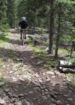 real distinctive end point, road crossing or trail marker. Just our GPS units showed that we'd reached the end of the segment. We'd covered 15 miles so far, but were not even half-way through our day. We spent a few minutes eating bars and food and contemplating what lay ahead, trail and weather-wise.
Segment 18 was 21 miles long, approximately. We'd chosen to combine the two sections based partly on the trail descriptions in the official guidebook, and on the availability of car-accessible campsites. it was becoming increasingly obvious that the official guidebook had been written by hikers with only a sidebar mention of mountain biking. It was not written from a mountain bike perspective, and was sorely lacking in details of importance to those of us who choose knobby tires over boots.
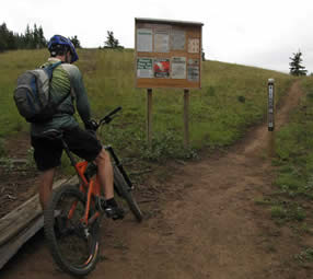
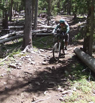
The next section was described as a net downhill in the guidebook. It proved to be more of the same. We spent the next four hours riding/hiking our bikes up steep climbs, and picking our way through rock garden downhills, covered with slippery mud. Our bikes were loaded with mud and weren't shifting well. The few smooth sections were like rest breaks, but all too often were too short to make a big difference.
Drizzling rain and mud prevented us from taking too many photos, as we couldn't take cameras out in the rain. But we still managed to get enough to illustrate what we were going through.
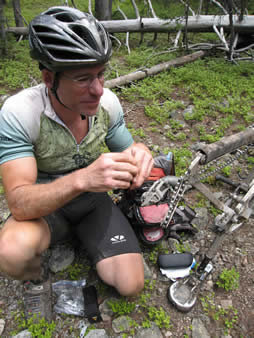 Hans broke a derailleur hanger at about 23 miles, and had to stop for the repair. He was having trouble removing the broken portion of his old hanger, but struggled with it, and with Ed's help was able to get it off. That repair took a good 20 minutes or more. Steve had gone on ahead, since he was having to ride the downhills slowly. His front brake was fading and spongy, as if there was air in the hydraulic line.
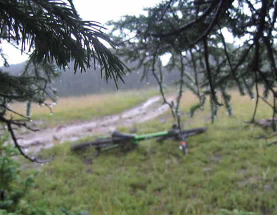
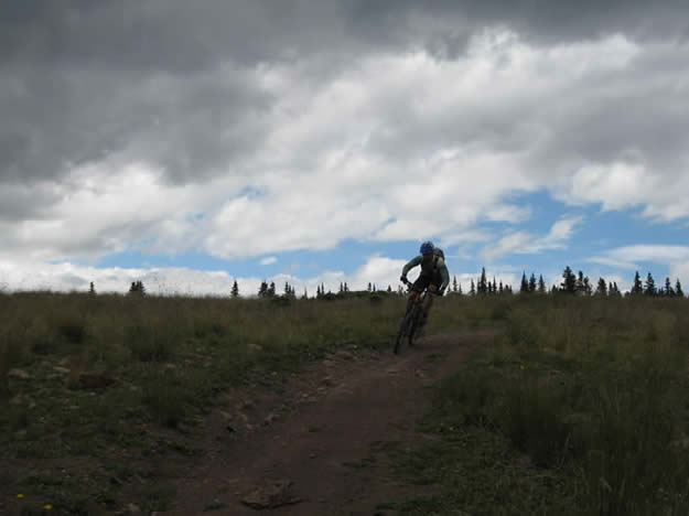
The trail opened out into a fast flat downhill across Sargents Mesa and a large meadow. Steve waited there for the rest of the group. This downhill was about two miles long, but much faster and smoother than the previous downhills. The sun had come out, but the bliss proved to be short-lived. Clouds rolled in again, just as fast as they had cleared out. The trail soon headed back into the pine forests and got steep and technical again. By this time we'd been on the trail more than five hours, and were all feeling fatigued from the seemingly endless mud and rock.
Again the trail reverted to a series of steep switchbacking climbs up loose mud and rock. We were almost all hiking our bikes up the hill, and taking the beatings going down. It again started to rain, and was getting gradually heavier and heavier.

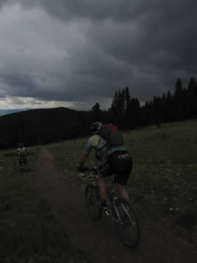
At about the 27 mile mark, we could hear the growls and cracks of thunder up ahead. It sounded like it was moving our way fast. Knowing there was a crest up ahead, we decided to sit it out, not wanting to be on top of a summit with lightning around. It started to rain, even harder now, and we chose to stop one more time. It was nearly 4:30 p.m. by this time, and we'd been on the trail since about 8:00. We spread out and huddled under trees. The lightning flashes were now overhead and all around, though we saw no evidence of ground strikes. We waited about 15 minutes, until the bulk of the lightning was moving north of us, and decided to keep hiking again.
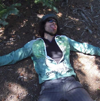
One last thunderclap sounded overhead, but we were undeterred. There was a lighter patch of cloud up ahead, and the storm appeared to be thinning. As we hiked the final ascent, a one-mile section that was smooth, but loose, the clouds broke and we hit the final crest in full sunlight. The trail was steaming, and we felt like we'd been delivered.
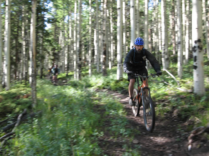
The final descent dropped 600' in 1.5 miles of switchbacking single track. It was the one last reward for what we'd endured. It snaked it's way through aspen groves and ended up on a fire road. The GPS and a check of the guidebook led us out along the fire road to the right, across a cattle guard, and down another fire road where we joined highway 114.
Phil was waiting there in Ed's truck. He'd been waiting there for quite some time. It was now almost 6:00 p.m. Hans jumped in the back of the truck, not wanting to sit inside the cab covered in mud and soaking wet. The rest of us rode about a mile climb to the summit of North Pass on Highway 114, then about 3.5 miles of descent to Buffalo Pass campground, where Phil and Ed had scrambled to keep things dry during the passing storms.
We ended up with 40.5 miles of riding, including the 4.5 mile road ride to camp, 6500' of climbing, 8200' of descent, 6:52 ride (and hike) time, and just over 10 hours on the trail (or hanging out under trees waiting for rain to ease up). There were two major mechanicals: Shawn's broken chain and Hans' broken derailleur hanger.
Kidney belts would have been good to have, even with six inches of travel. Shawn, on his SID, had trouble with his wrists and hands. It's hard to put into perspective how difficult this section of the Colorado trail was, but we'll try: Think the rockiest sections of Tunnel Trail (without the big drops or waterfall section).... then throw in slippery mud, hail and rain.... then make all the rocks roll around and move.... then do it between 11,000 and 12,000' elevation.... then go back up after you've come down... then do it all over again. Oh, and while you're at it, through in a thunderstorm for half an hour. It was a tough day!
Dealing with the rigors of this section of the trail was a mental challenge as much as it was physical. Many of the downhill portions were as demanding as the climbs, and most of the climbs were too loose and slippery for us mere mortals to climb (Shawn and Rooney made more of the climbs than Hans, Ed or Steve did on their freeride bikes).
Emerging into the sunshine for the final descent felt like bliss. Through the day there was a pervasive concern about what lay ahead, and whether we were up for the challenge. So many unknowns. But it is those unknowns and those challenges that brought us here in the first place, and we made it through another day on the trail. And we're loving it.
© 1994-2014 Over the Bars Mountain Bike Club. All Rights Reserved