|
|
|
|
|
|
|
|
|
Colorado Trail MTB Bike Tour
Day 3 - The Ride Begins
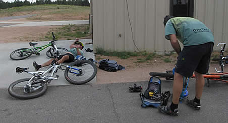
July 23, 2006. Awake at 5:30, Hans started getting things together for breakfast. We were all tired, the drive out having sapped us, the two rough nights with little sleep didn't help. Steve made pancakes, while Ed and Hans got ready to take Phil's bike to the bus station and lock it up. After breakfast they left, as everyone else was left to pack up camp and get ready for a speedy departure.
When Ed and Hans returned, Glen let everyone know that he didn't think he could ride. His knee was visibly swollen, probably from sitting cramped up in the back seat of Ed's truck for two days, with hardly any rest stops. That sucked, and it changed everything. We could leave the truck with Glen, and he could pick up Phil from the bus station. It meant that only four of us would ride this first day.
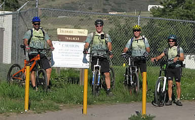
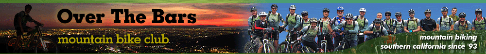
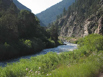
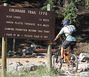
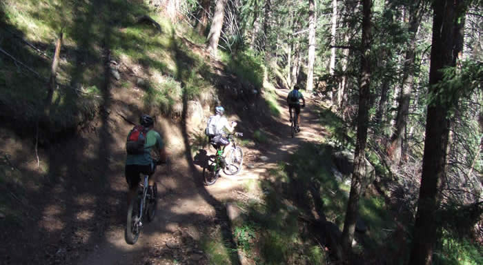
It was 8:00 a.m. before we actually hit the trailhead. Ed, Hans, Steve and Mike started out from the Colorado Trail trailhead (east), which is a Denver Water District service road for a few dams. It's a flat 8 mile dirt road with some great scenery alongside the river. We set up a paceline and cruised up the dirt. It was a great warm up. We passed so many people just heading out to do a little fishing, or ride the mellow road up into the mountains. There were rest stops all the way up....really nice.
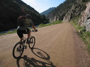
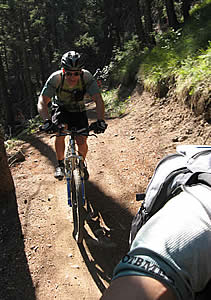
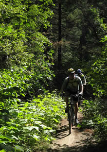
But at the end of that, just past the second dam, is where the fun begins. We climbed from there on the single track, leapfrogging, and taking photos all the way up. It was a great climb, and doable for the most part. Steve and Hans cleaned a steep, technical section that the locals had hiked up. They were definitely impressed... it was a hard section, and they were on lightweight hardtail cross country bikes. We talked to them for a bit, and they told us a little about what we were in for. It was a good climb.
 After the first climb we descended a short way, then climbed again, but this time, much more difficult. We were approaching 7000 feet, but the trail was in pretty good shape. It was smooth, tight turns in places, not too many technical sections, hard-packed for most of it, and loose in some others. It there was a good 2/10ths of a mile hike-a-bike section that was too steep and loose to climb.
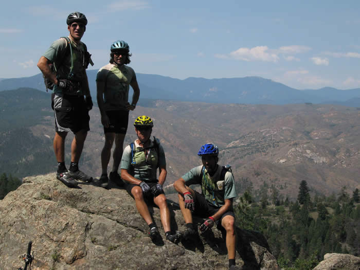
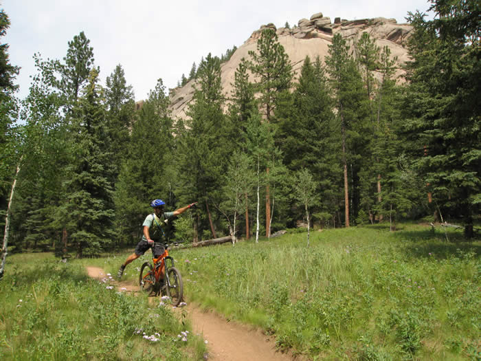
We made it to the top and got our first sweeping vistas of the mountains and the burned out area that we'd be riding through on the next section.
The descent from here was amazing... switchbacking downhill for five miles!
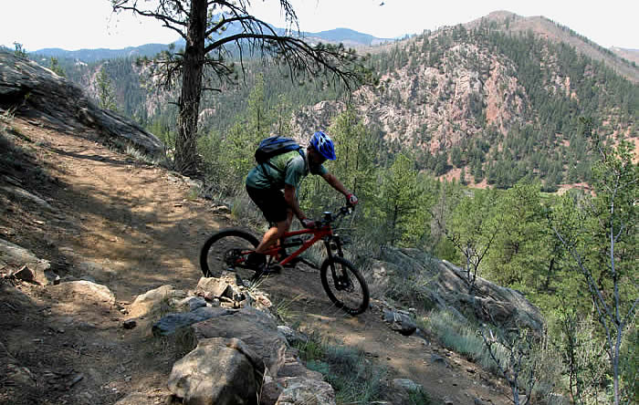
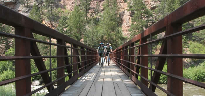
The end of this descent was the end of the Segment 1, and a great section. We all felt pretty good, thought we had plenty of water left, so we crossed the bridge over the South Platte River that starts Segment 2 and kept riding. We didn't stop to get and treat water from the river.
The climb from here was hot, loose, and exposed to the sun. It was equal to the tight switchbacks that we'd just come down, and drained us all. On Steve's skinny 1.9 tires, he couldn't make the switchbacks... his tire would just slide sideways. Ed's long wheelbase couldn't make it around the switchbacks, so we all did a lot of hiking.
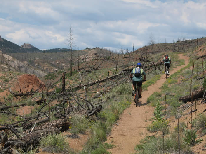
The climb leveled off slightly, and we entered the area of the 1996 Buffalo Creek Fire. It was ten years ago, and the area hasn't recovered. It's a stark and barren burned out landscape that is strikingly beautiful, and incredibly hot.
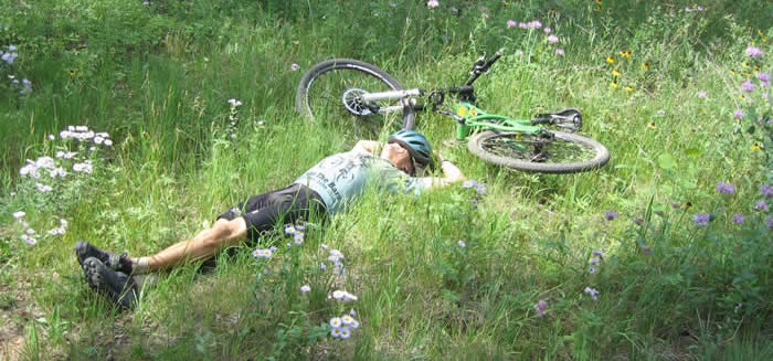
The views were great, but after the loose climb, the heat did in Ed. He bonked at 18.2 miles, and ran out of water. Of course, the new guidebook says to "make sure you get water at the South Platte river, as the section after it is the driest and hottest on the Colorado Trail.
So Steve hung back and shared his water with Ed, while Hans and Mike waited at what they thought was the summit. It was a tough ride. Ed had driven for two days, and hadn't been doing much hydrating on the way. Hindsight is 20/20, as they say. It took about half an hour for Ed and Steve to get there, and Hans was out of water by that time as well. Steve still had half his bladder left, and shared with everyone. We estimated it would be about 5 miles to water, and mostly rolling terrain with a slight net downhill.
 We rode this last section, and it was great fun. At the end of it, the trail crosses the SR 126, and a fire stationg is a few hundred yards north of where the trail meets the roa
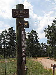 d. We headed over there, and found nobody at home. But there was a water spigot around the side of the building and we all filled our bladders and ate.
From here the trail got much easier. Ed was getting a second wind (but constantly on the verge of cramping), and the trail headed downhill for a little way, first along the side of the highway, then cutting across the highway and becoming a fire road for about a mile.
After passing a bunch of horse trailers, the trail turned to swooping, downhill single track. it was great fun, good clean surface, and very well marked. We passed a few more riders on this section, it was obviously a fun one. The grade was gentle enough to allow you to go really fast, without any big surprises. Eventually this trail came out on the FS 550 (Forest Service road), to end Segment 2.
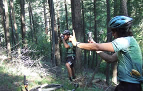
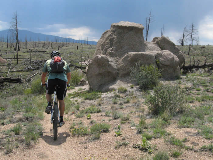
Segment 3 was great single track and we all agreed it was our favorite. It was a fast, easy grade, with gentle rolling climbs and spectacular aspens, wildflowers and rock formations. There were even paparazzi all along the trail, mysteriously shooting photos to be sold to some club web site for ransom....
The most amazing thing happened on this section. Hans was out in front flying down the trail as usual, and came around a bend in front of two horses coming up the trail. He locked up the brakes, and stopped just in front of them.... They APOLOGIZED for interrupting our nice "slalom downhill!" We knew we're not in California when that happened!

We came upon a meadow, and a grove of aspens. There were wildflowers everywhere, and the looming thunderstorms that had earlier seemed to be on the trail up ahead had never materialized. So we felt we'd earned a little break and stopped for a few minutes to enjoy the scenery.
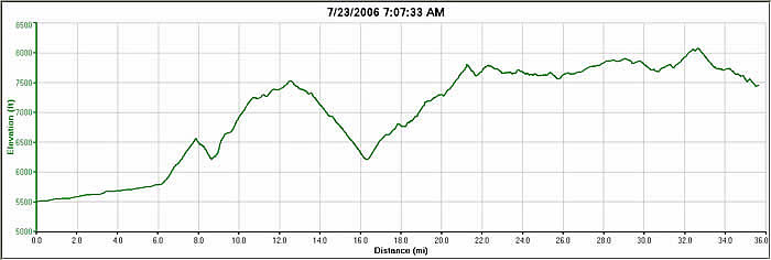
We made camp at Buffalo campground after just over 8 hours 15 minutes on the trail, with a 5:19 ride time, 35.12 miles, 6000 feet of climbing and 4001 feet of descent. Finding the campground was a little confusing becouse the map called it Buffalo Creek and the signs said just Buffalo Campground.
© 1994-2014 Over the Bars Mountain Bike Club. All Rights Reserved