|
|
|
|
|
|
|
|
|
Colorado Trail MTB Bike Tour
Day 7 - Ten Mile Pass
July 27, 2006.- According to the guidebook this section has a"Recommended Bicycle Detour: Take the 15 mile paved bike path. This avoids an arduous and difficult ascent that requires expert single-track handling skills."
We did them both (The detour and the "arduous and difficult" ascent). The bike path was great. The ascent was arduous and difficult. The descent was great. Then the bike path back was really fun as well.
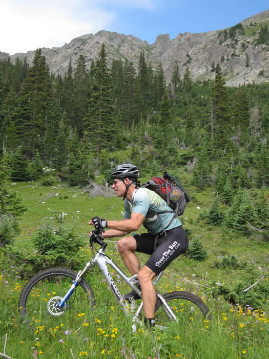
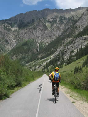
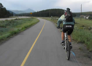 We started out the morning riding from the camp on Lake Dillon. It was a treat not to need to break down camp in the morning, since we were going to ride a loop. We headed out to the highway and took the bike path that runs between Copper Mountain, Frisco, and Breckenridge. It was a real treat to be able to warm up on the bike path, cruising down the smooth paved path, weaving through the trees, away from the highway, at 30 mph. We did 6 miles on the bike path.
Hans and Steve had jumped the gate and sprinted out, hammering so hard that they passed the Colorado Trail trailhead. With a radio call, they were summoned back. It had been really cold the previous night, camping at nearly 10,000', and there was a good chill in the air in the morning, especially at road riding speeds. At the trailhead, everyone took off their cold-weather gear knowing we were in for a big ascent.
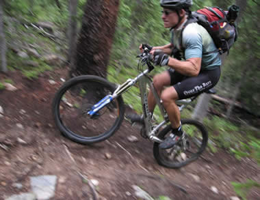
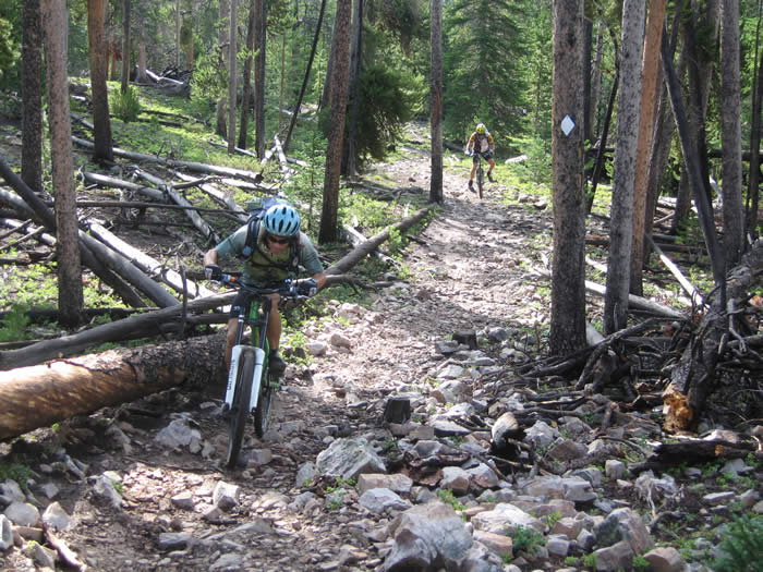
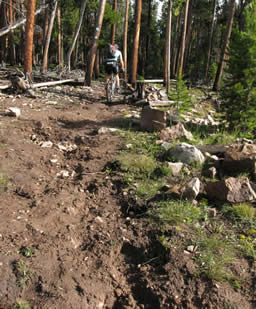 The trail up began as a steep (15-20% grade) slog through slippery clay and mud amongst the pine trees. It was all rideable, but was definitely a challenge not to spin out the back wheel. Eventually the trail cruised up to a fire road, which it joined for a hundred feet or so, with a slight, but extremely rocky and rough descent. Apparently this was a new section of trail that hadn't yet been surfaced and cleaned of rocks, and with all the recent rain (It had rained every day except one for the past two weeks, we found out), it was rocks with slippery clay and mud in between.
 \
\
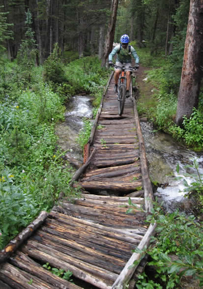
Then the descent was short-lived. We crossed a bridge and a small creek before beginning even more of a slog up the hill.
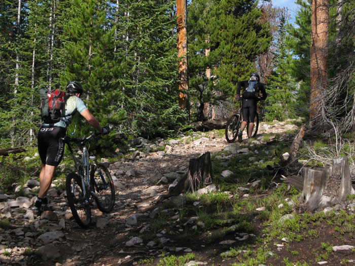
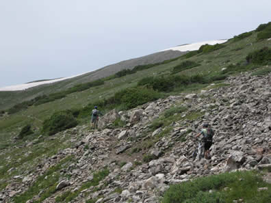
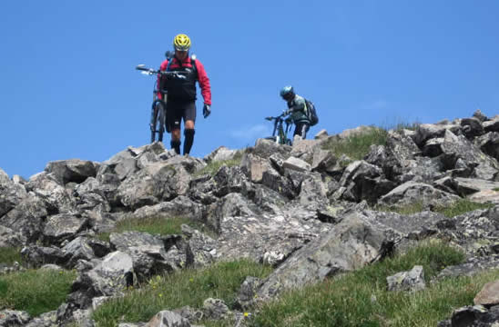
 It never let up. Accordoing to our Edge GPS units, the grade in places was over 40%. It was rocky, technical, and even difficult to walk on. We were constantly on and off the bikes, riding for a short stretch before hitting and impassable hike-a-bike section, and so on. We probably hiked a third of the time until we approached the treeline at about 11,500'.
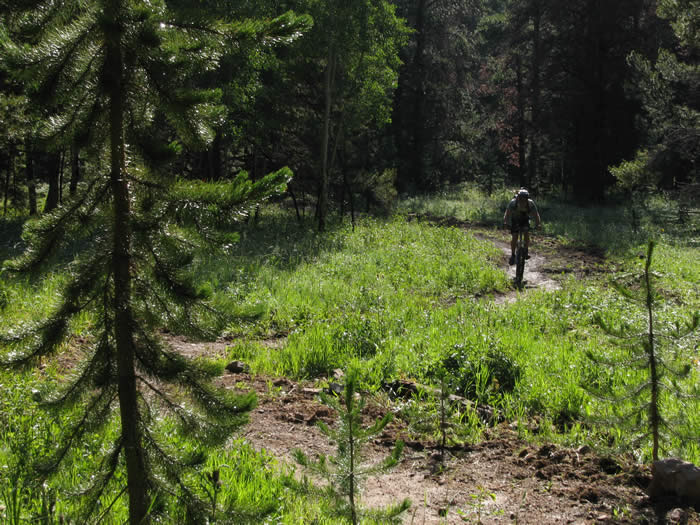
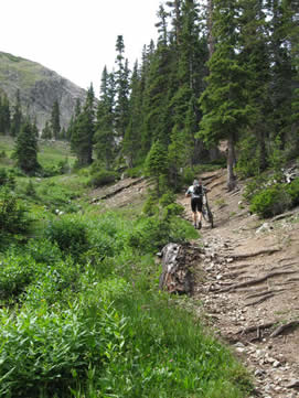
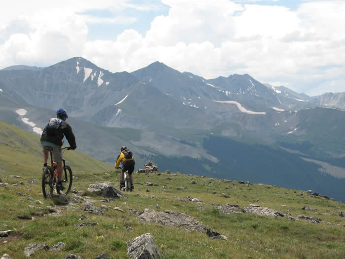
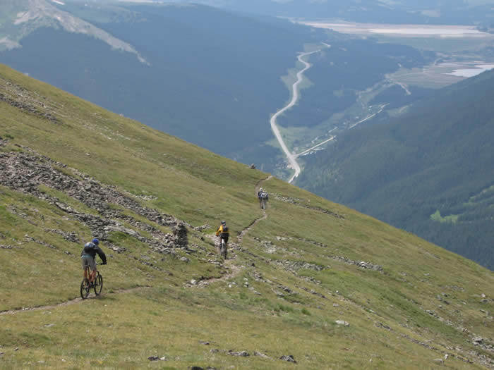
The trail opened out into some spectacular meadows, passing below and to the east of ten mile peak, with patches of snow all around. We passed through a few more short forested sections before finally ascending above the treeline.
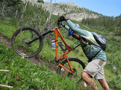
 Then the trail got steep. Really steep. It was hike-a-bike most of the way to the pass from here. Rocky and difficult, approaching 12,000', we were all feeling the altitude. The morning's difficult and technical muddy section had sapped our energy, and that combined with the altitude made for an extremely difficult going.
We reached a false summit at around 12 miles (including the 6 miles of bike path), and spent a few minutes talking to some hikers who were heading to the pass as well. They thought we were crazy trying to do this section on bikes, and none had ever seen a bike on this section. One of them guided backpacking trips up here.
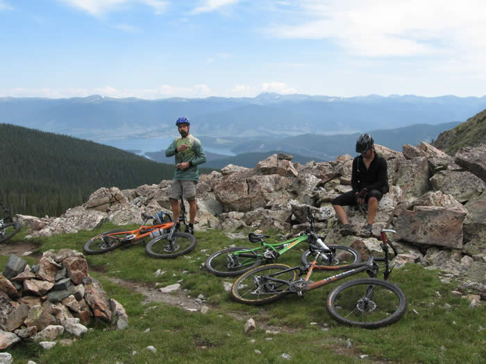
 The hike (there was no riding) to the pass from here rose another 800' or so, again mostly impossible to ride. We hiked up, rewarded with spectacular views of the lake below, and the mountains beyond. We could see Georgia Pass, where we had ridden two days ago, and mountains beyond.
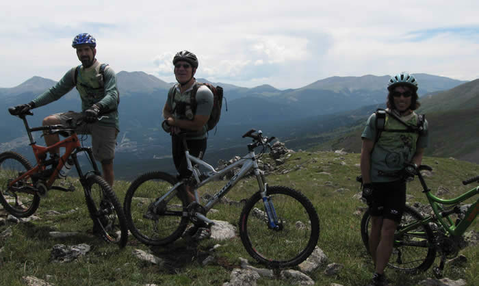
The group spent about an hour at the top. Hanging out and trading stories and photography services with the two hiking groups that were up there. The weather had cooperated, and we had great visibility and no rain or thunderstorms, unlike our previous day's rides.
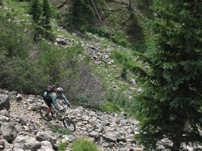
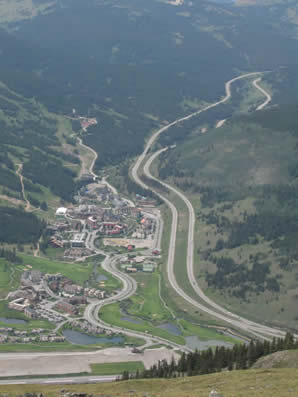 Riding to the western edge of the pass, it looked as if we were looking directly down on Copper Mountain ski resort. The hill just rolled over and was a straight pitch all the way to the town below. Our path took us south, along the ridge line and to the south end of the pass, before turning downwards to the west. It was easy and forgiving single track at first, but got gradually steeper, more rocky and more loose as we descended.
Steve tore the sidewall of his lightweight tires, and had to put in a duct tape boot and new tube on the way down. He retired those tires at the end of this section, impressed with how long a 310g tire held up and performed. After the repair, the trail became easier, swooping down through the pines, with some sections of roots and slippery rocks, but mostly fast, smooth (but steep) single track. The descent dropped about 2,400' in about 2.5 miles.
There were a few rocky sections on the descent that kept it interesting, but for the most part they were steep, rideable and fun.
The trail came out by Copper Mountain after 18 miles, and we headed down the road to join the bike path. Phil was parked at the start in Ed's truck, which now sported new tires (the old ones had begun to show signs of wear and had cracks around the treads). We chose to ride down the bike path, knowing it was a descent most of the way back to camp.
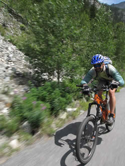
 Again, we were thoroughly impressed with the bike path. It cruised down alongside a river, away from the highway. It even had it's own dedicated bathrooms, and led all the way back to Frisco, and back to our camp at the Lake. We'd hit speeds of 35+ mph on the path, which went for 9.25 miles and dropped about 1000'.
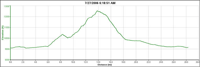
The views from Ten mile pass had been well worth the difficult ascent. According to the Edges, we'd peaked out at about 12,580', we'd covered 21.4 miles, and had a cumulitive elevation gain of about 5,000' most of which happened in about 3.5 miles. In the graph below, everything to mile 6, and after mile 18 was bike path. The big lump in the middle was the Ten Mile Pass segment of the Colorado Trail, not recommended for mountain bikes (but we're sure glad we did it!).
© 1994-2014 Over the Bars Mountain Bike Club. All Rights Reserved