|
|
|
|
|
|
|
|
|
Colorado Trail MTB Bike Tour
Day 8 - Searle Pass, Kokomo Pass
 July 28, 2006. The previous night, Phil met a rider who was about halfway on his ride from the east coast to Oregon. We invited him to camp with us, and he was a great character. 59 years old, he was making his way from Vermont to Oregon. What an inspiration. He was riding solo, with front and rear paniers, and fully self-supported. Something to look forward to.
This was our first night without any rain. It was a pleasure... but even colder than previous nights. We had a pancake breakfast and packed up camp. It seems to be taking us about 2 hours to get packed up, fed, and on the road. We shuttled back up the highway to Copper Mountain, where we'd finished the trail yesterday and from where we'd ridding down the bike path back to camp.
The trail here had been re-routed since our guidebooks were written and published, and lots of it was new. It didn't make much sense, as it climbed and descended, and switchbacked up one ski-run, ran through the trees, then switchbacked down another. The trail had been chewed up by horses, and was in really rough, muddy shape. The trail weaved it's way behind the buildings of the ski resort, emerged onto a fire road that passed under some ski lifts that were operating on a site-seeing basis (we guessed, since there was no snow).
The horse manure and torn up trail was pitiful for most of the first three miles. It made for really rough riding, and left no doubt as to which trail users have the greatest impact, especially when conditions are wet. For a while our trail diverged from the path the horses had taken, but the horse trail soon joined us again. But eventually, we crossed a small bridge and saw no more recent horse tracks or dung piles. From here the trail turned to magic. It was mostly rideable, steep in places with some tricky sections, but 99% rideable. Just a few muddy sections, and one or two steep sections had the group hiking.
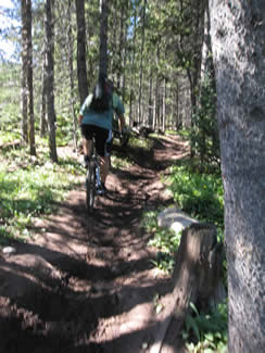
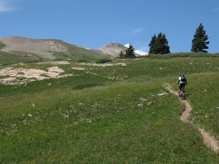
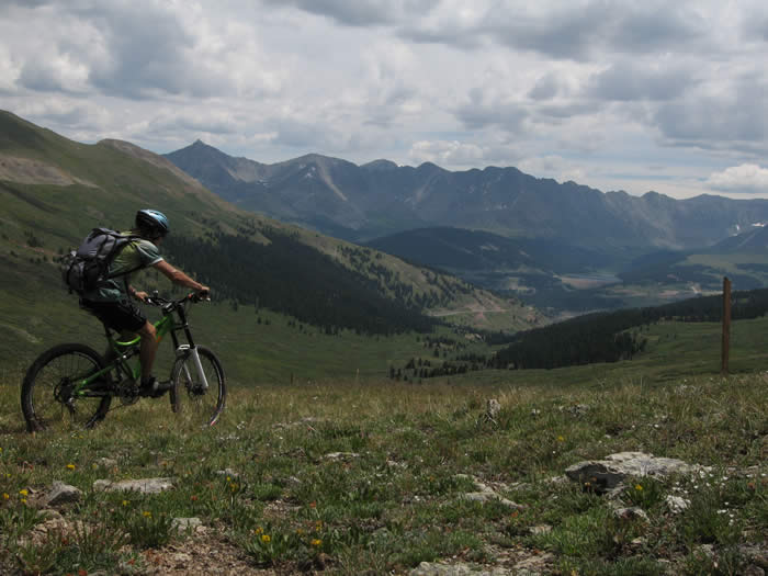
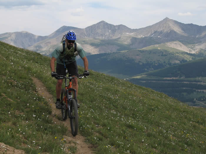
We followed a creek up a valley, with Searle pass visible at the top of the valley in the distance. It was a beatiful sight, especially with the fluffy white clouds and blue skies we'd been blessed with for the day.
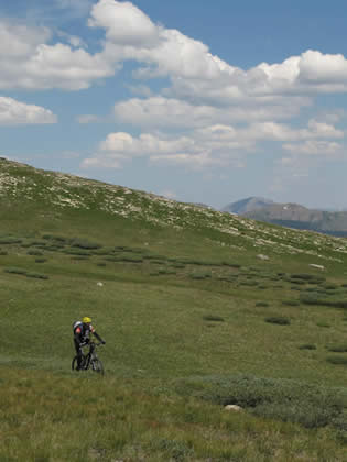
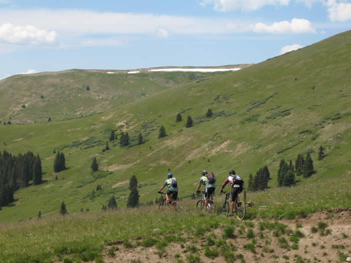
We wound our way up along the creek and stopped along the way for photos and food. When we hit 11,800' the grade flattened out slightly, but the altitude was again taking its toll. We tarried on through meadows, across streams, just below the ridgeline we'd be crossing soon.
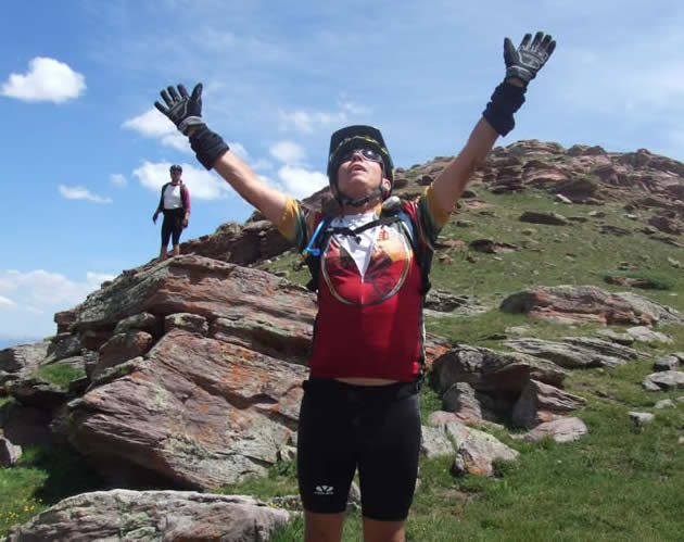
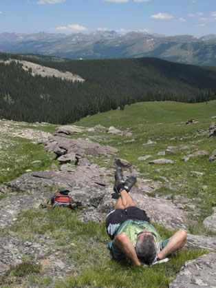
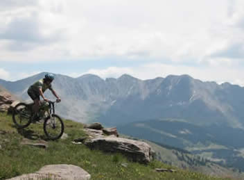
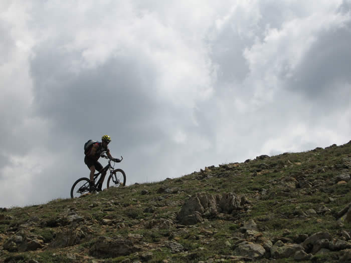
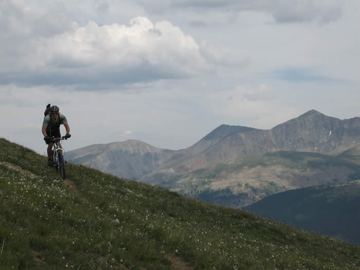
The final approach to Searle pass got pretty rocky in places, but still, with determination and hard breathing, was rideable. Steve stopped and took photos all the way up, and was the last one up. The views were out of this world... peaks visible in all directions, snowbanks and streams, freshwater springs emerging from the ground, and perfect 70 degree weather. It was bliss.
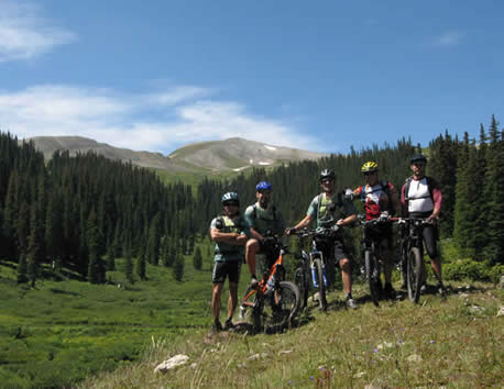
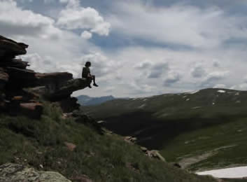
We hung out at the top of Searle pass for nearly 45 minutes, just basking in the majesty of the rockies all around us.
We had only passed on hiker, the same woman we'd seen the previous three days hiking each section west to east, but in east to west order, if that makes sense. She was part of a group that we'd spent time with at the top of Ten Mile pass, and she was driving shuttle, then hiking backwards on the trail to pick up their second vehicle. She was definitely fit and fast....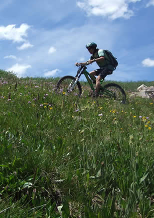
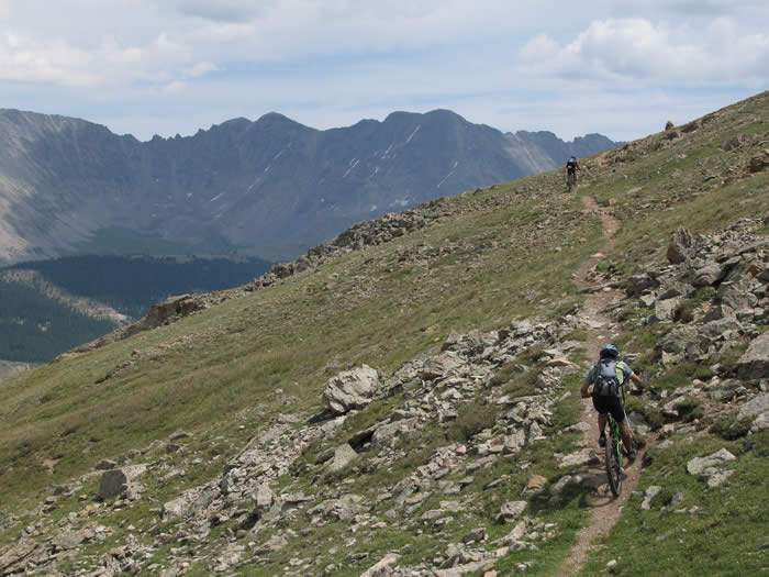
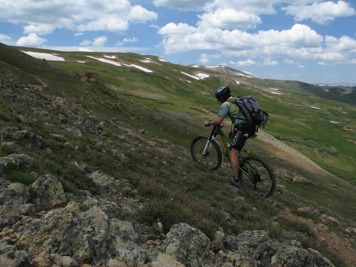
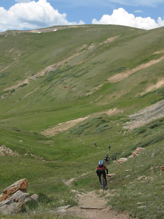
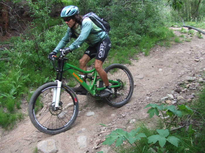
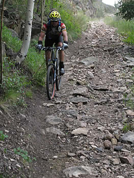
From the top of Searle Pass, we climbed a little more up and over the ridge line we'd been following. The trail here got very rocky and about 50% of this section was a hike-a-bike. There were stream crossings, boulder gardens, and sharp rocky sections.
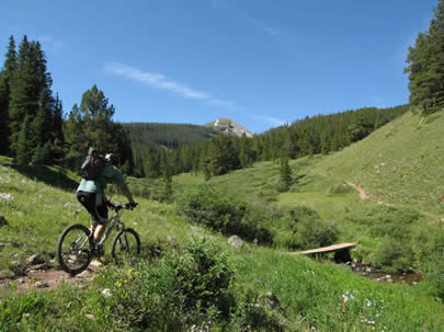
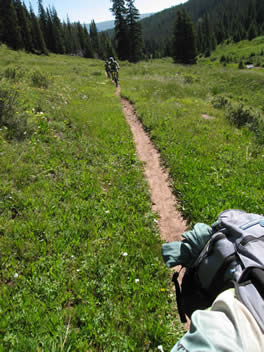
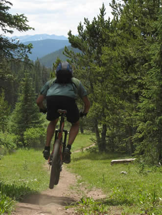
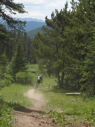
 Most of the trail to this point, and on the descent, was really narrow single track. Narrower than we are used to in California where dry conditions allow the trails to gradually widen at ground level with use, while the plant life grows in from the sides. Different here, the grasses in the meadows grow right to the edge of the trail, leaving the trail almost like an 8" wide rut through the grass. It keeps you on your toes, as the walls of the rut, topped with grass, will grab your front wheel unexectedly if you let your attention wander. And that's hard to do with so much great scenery.
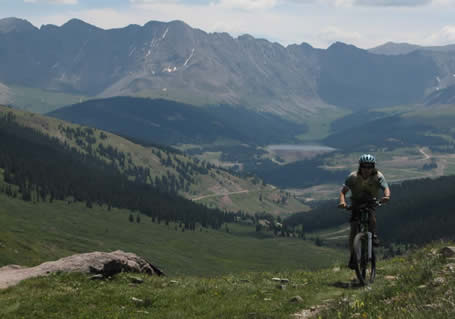
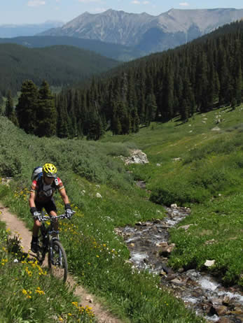
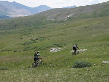
 From the top of the ridge we descended down to Kokomo Pass. This was a great, fast, technical single track. It kept you on your toes, for the reasons above, and for the fact that it was fast. We were hitting speeds of 20+Mph, weaving down through the 8" wide rut lined with rocks and grass. Super fun!
The trail down was pretty steep, and a steady gradient. Once we were on the descent there were no climbing sections at all until we got to the bottom of the grade, by Camp Hale. We saw our first dust since being in Colorado as well. The trail was dry, as there hadn't been much rain in the past two days up here, or so it seemed.
In places the trail turned into what appeared to be the remnants of a jeep trail or double-track, but a lack of bridges meant that no four-wheeled vehicles had been here in a while. There were lots of steep, rocky sections that were reminiscent of Silver Mocassin, though with far different scenery.

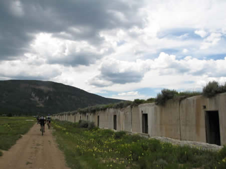
We passed a waterfall at the bottom, before emerging onto a dirt road, from where we contacted Phil, and tried to find the camp ground. We passed the bunkers, from which the U.S. Army did their high-altitude and snow training for world war II. A litle bit of history here, and the campground was dedicated to the Army's 10th division, who suffered over 25% casualties during the war, mostly due to their precarious mountain deployments in northern italy and other places.
We eventually found the campground and got settled in for the night. It was hot, over 80 degrees, but rapidly cooled off as the night came over us.
Bill and Rooney arrived about an hour after we did, and we had a spagetti dinner, and tried to decide which trail we liked better, this or the Georgia Pass segment. Both were phenominal, had great views, but this trail had more technical terrain, and we'd had better weather.
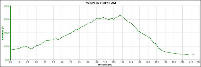
The day ended up being a 21.4 mile day, with 5,000 ascent and nearly 7,000 descent, and a peak elevation of 12,300'. It was only 4 hours ride time, but we'd spent nearly 7 hours on the trail... taking photos and having a great time.
© 1994-2014 Over the Bars Mountain Bike Club. All Rights Reserved