|
|
|
|
|
|
|
|
|
Colorado Trail MTB Bike Tour
Day 12 - Browns Creek and Chalk Creek Trails
August 1, 2006. We had an early start this morning. Hans was getting things going a few minutes after five in the morning. It had continued raining all night, and was still raining when we got up. We were unable to ride the next section from the camp, as it was designated wilderness, and closed to "mechanized" travel. The Collegiate Peaks Wilderness has several 14'ers within a short stretch. It's a bummer we can't take bikes in there, and completely unfair. Our plan was to break down camp, drive the three vehicles to Buena Vista, and leave Shawn's and Rooney's cars parked in the town. Then we'd all pile into Ed's truck (7 people, 7 bikes, 7 tents, and all the camping gear), and head to the trailhead.
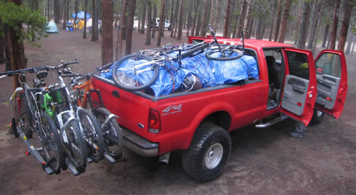
The plan went pretty smoothly, and pretty wetly. Everything was soaked from the night's rain, but nobody let it deter them. None of us were looking forward to starting a ride in the rain, but we are on a mission, and a little wetness wasn't going to deter us. In fact, we set a record for breaking down camp and getting on the road. It certainly goes easily when everyone pitches in.
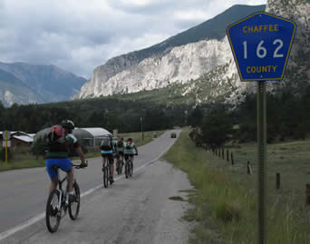
We were on the road shortly about 7:30, in a light rain, and thick overcast skies. But as we left the canyon in which we'd camped at Half Moon West, the clouds broke a little and it stopped raining. We headed South on Highway 24 along the Arkansas river. The official Colorado Trail guidebook had recommended a detour around the wilderness areas that was essentially a ride down the highway. Even though it was downhill, none of us were here to ride highways, so we had opted for our current plan, to drive around the wilderness area and ride the portions that were open to us.
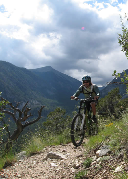
We headed up the Cottonwood Canyon Pass road, and found the trailhead, even though there was no sign on the highway. We were riding by 8:10 a.m.
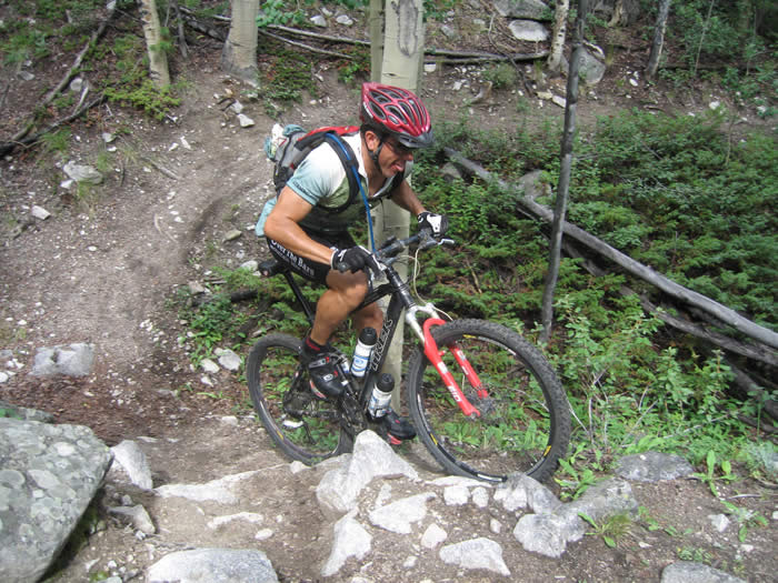
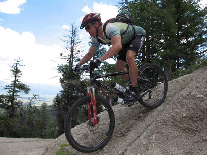
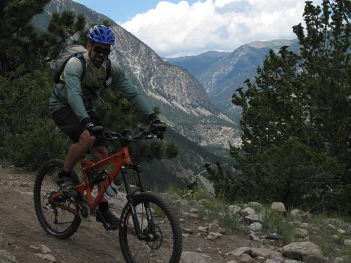
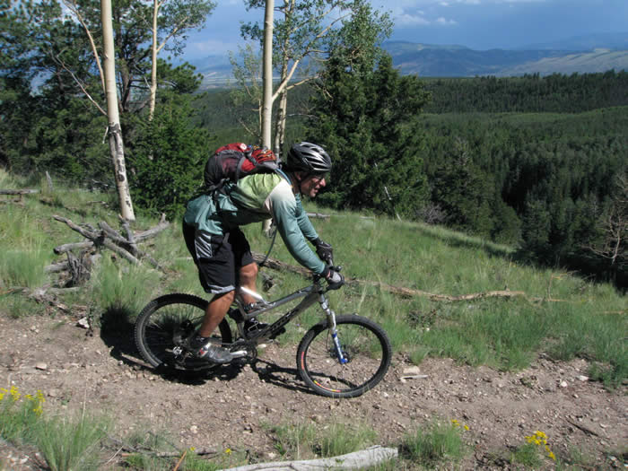
According to the guidebook we would start this segment with three miles of downhill before beginning a steep climb. According to our GPS units, we climbed over 200' and dropped 500' in that three miles of downhill, so it's easy to see why the book is so far off from our readings. We skirted the edge of a lake and had some great technical riding, with damp earth and lots of rocks to pick your way through.
A group of horses came by... it looked like a guided horseback tour since most of the people didn't look like horse types at all... they had that inimitable "tourist" look to them. But they were friendly. The next several miles of the trail was completely cut up, with loose rock, trampled mud and horse shit everywhere.
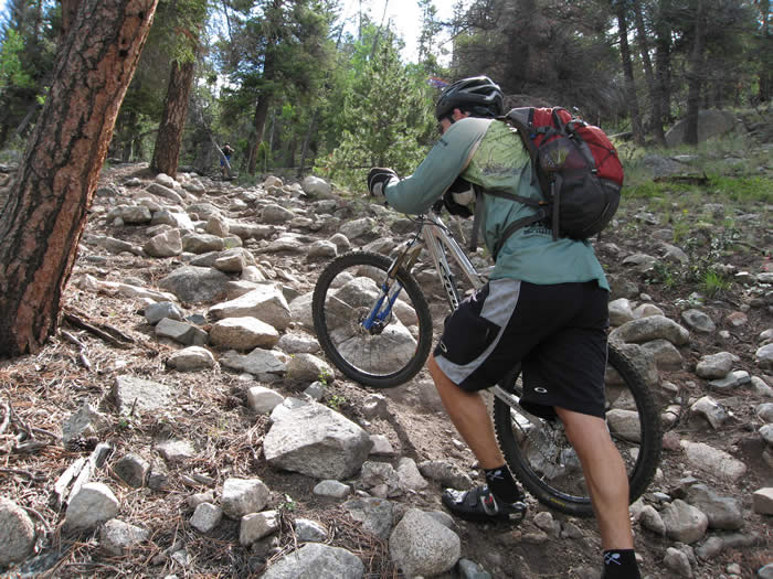
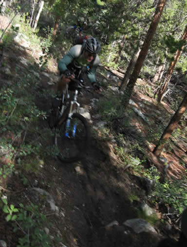
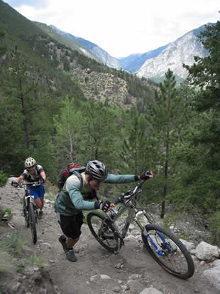
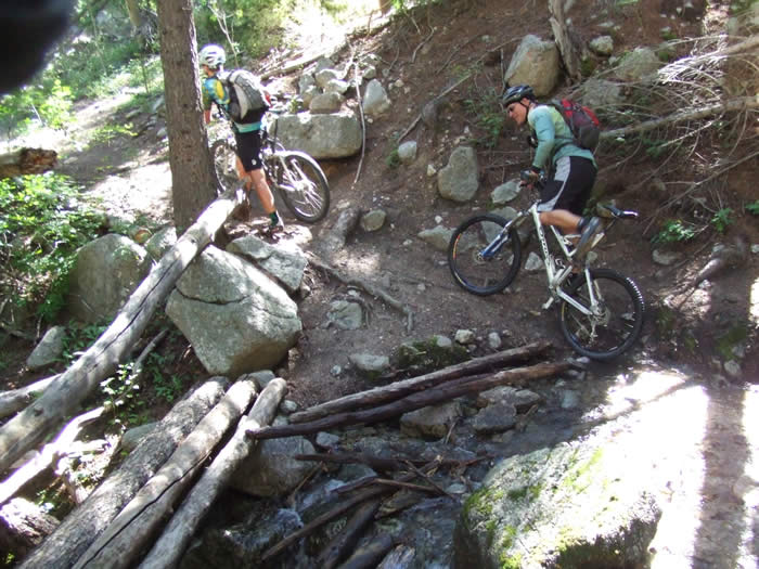
Once we began the first significant climb, it was obvious that we were in for a rough one. It rose about 900' in elevation in just under two miles. The trail was extremely loose, steep and rocky, and much of it required hiking. There were lots of fallen trees across the trail, and were only able to ride very short sections before the trail got too difficult to ride. The muddied hoofprints and slippery roots didn't help either. But the dirt, when it was more sandy so the rain could soak in and make it sticky, was much smoother with pretty good traction.
Even though we'd taken a day off yesterday, Hans, Ed and Steve were definitely feeling the fatigue in the morning. It almost seemed as if the day off had allowed them to stiffen up instead of recover. But we plodded on regardless. The thrill of actually being here and being close to the half-way point of our ride was worth it.
Shawn had just come from a road race in Flagstaff on Sunday, and Rooney seemed just as strong and fresh in the morning.
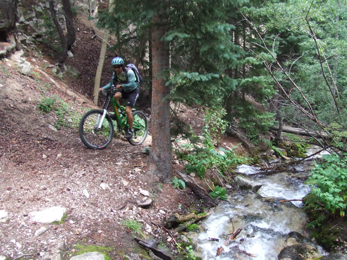
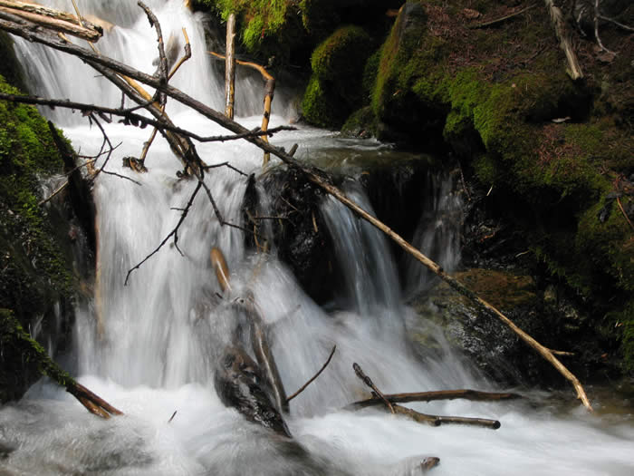
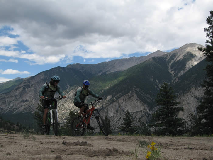
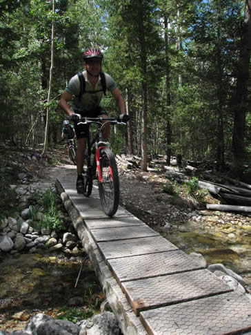
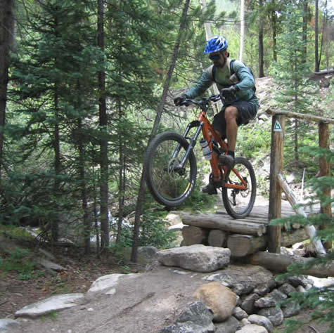
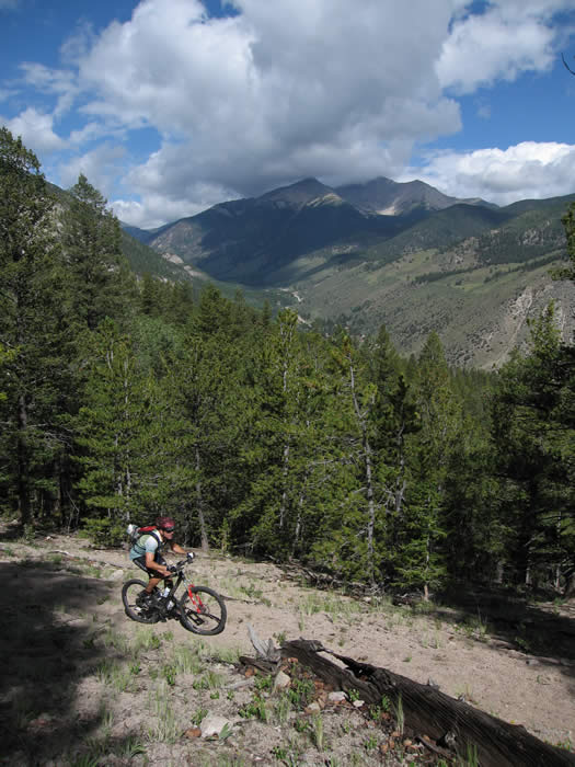 Once we made that first climb we had views down the valley from which we'd ridden, and the clouds were breaking up. The trail became continuous rolling up and down terrain with lots of creek crossing and bridges, lots of short descents down to creeks, switchback across them and climb up the other side.
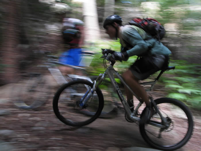
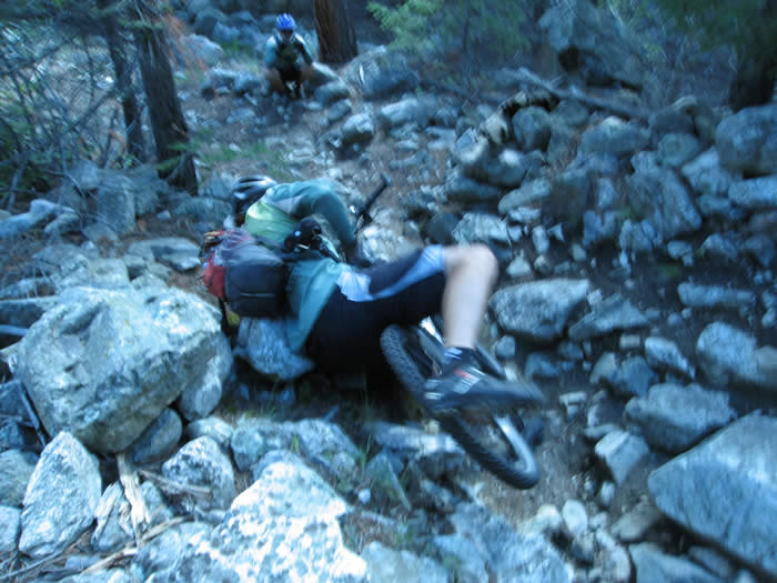
The trail through this section was so much fun... we forgot about the hike a bike and how much we'd been hurting, and just soaked it up. Rooney went down on a steep little climb after a bridge, and fell off the trail. But he went back down and rode it the second time, not to be outdone by a little loose rock.
We eventually emerged onto a fire road (actually a radio antenna service road) and took it down. There were 2-3' humps every couple of hundred yards, large smooth water diversions, that made it really fun to get some air on the way down. Shawn took a little ridge-line detour for some style points.
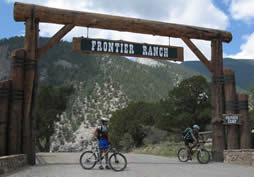 We followed the dirt service road down to the entrance of the Frontier Ranch Private Camp. It looked like a summer camp setup, and from what we could see from the gate, would have been a fun place to be if you were twelve and into summer camps. They were having a rodeo, and we could see water slides and other fun stuff.
Here the trail merged onto a sealed road, and the signs became pretty scarce. The guidebook said we'd be on black-top for 5.5 miles, but the signs were all worn out and unreadable. We were able to find our way by following the GPS waypoints that Steve had loaded into his Garmin edge.
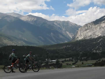
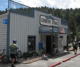
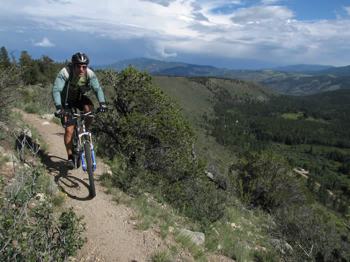
The descent down the road was spectacular. There were silver cliffs up ahead and the road wound it's way towards what looked like a glacial valley. We contineud down the road, and eventually came to a junction at which there was a country store, and a number of hot spring resorts. We took the opportunity to fill up on water, and headed up the road towards the next trailhead, the start of segment 15.
All sorts of cabins lined the road as we climbed up. It was a great little area, but looked like it would be difficult access in the winter. At this point we were only at 8,126' elevation, the lowest we'd been since we left denver. We knew the trail ahead would climb back up over 10,000' but didn't care. The weather had cooperated, and had been a spectacular day, in fact, and our spirits were high.
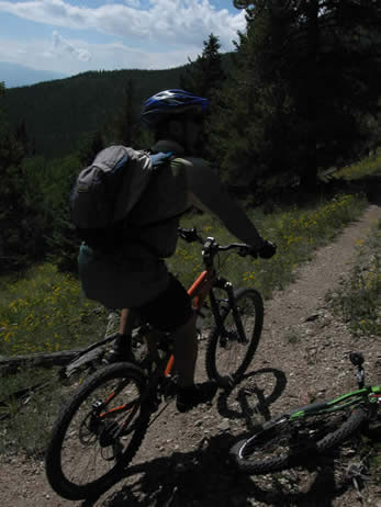
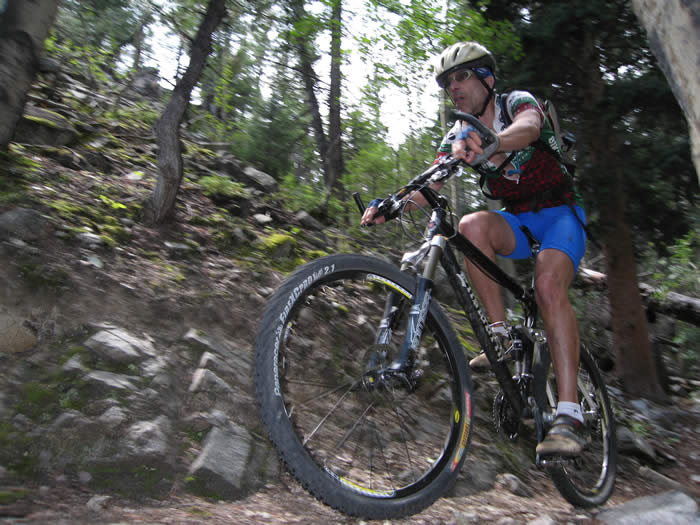
We started on the chalk creek trailhead at 12:31 p.m.having done about 15 miles so far. The gradient started out light, but quickly got much steeper. Though slightly steeper than our first climb this morning, This didn't have the horse hoof prints and loose rock, and was mostly rideable. Steve had let some air out of his back tire and was now climbing much better, as if he had a second wind. Hans was still feeling it, but trudged along well. Rooney and Shawn led the way up the climb on their cross-country bikes, and waited near the top.
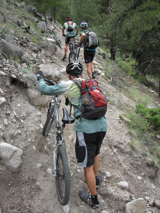

There were a few short hike-a-bike sections, mostly because of the loose sandy soil that was difficult to hold traction.
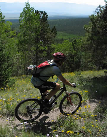
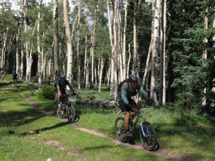
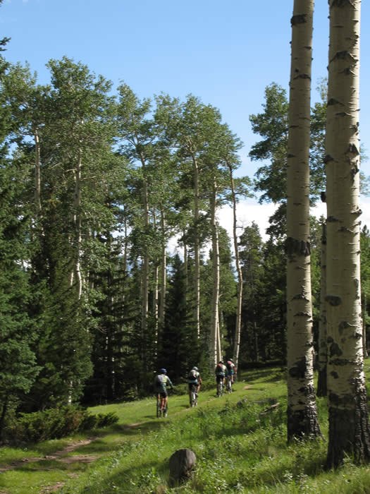
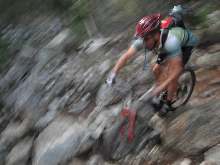
Once we reached the top, the trail turned to pure bliss. From here on out we rode a good 98% of the trail, with just a few short hike sections. There were smooth, fast, gradual descents that wound their way through the Aspens, Pines, and meadows, lots of little creek crossings, and a few technically challenging but rideable sections to keep it interesting. Nobody was talking about the hike sections any more... it was all fun.
Shawn had a mechanical... he broke a pedal and had to salvage some allen bolts from his other pedal to put it back together. Other than that, the ride had gone pretty smoothly.
We cruised out for another four miles before hitting the next significant climb. Again this was mostly rideable, but just challenging enough to make one want it. The trail continued rolling onward with some more climbs, descents and rolling fast technical sections. It was great fun.
The final descent to camp at Angel of Shivana (or Angel of Shimano, as Steve called it) was really great. There was an incredible view up the canyon, and some good fast single track.
Towards the bottom, very close to camp there was a short section of large rocks that dropped about 5' in a distance of 12'. Hans tried it and went down. Shawn tried it and went down, but hiked back up and cleaned it the second time.
We made camp and had a great dinner. It's now 9:00 p.m. and we're all heading off to our tents for some recovery. We've got a shorter ride tomorrow, but will climb from 9,000' up to 12,200' in less than 8 miles. It will be a big day.
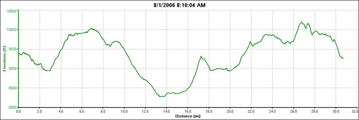
Our stats for the day included about 5100' of climbing, 5250' descent, 30.71 miles, and 4:50 ride time, but we were on the trail from 8:10 to 4:45, about 8:30 total.
© 1994-2014 Over the Bars Mountain Bike Club. All Rights Reserved