|
|
|
|
|
|
|
|
|
Colorado Trail MTB Bike Tour
Day 20 - Hotel Draw to La Plata Canyon
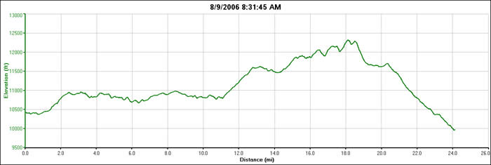
August 9, 2006. We'd decided to go a bit easier on ourselves today, and only do one segment instead of two. Segment 27 includes a section about 12,000', but is only 20 miles long, and much of the rest of the segment is fairly forgiving grades, or so our guidebooks led us to believe. But we'd had a couple of really tough days, and the prospect of doing over 40 miles again wasn't looking too good. We toyed with the idea of doing it in reverse, as the logistics were much easier. The end of the segment was about a 90 minute drive away, with some rough dirt and jeep road access. But we're riding Denver to Durango, so we drove up the road we'd come down yesterday, and started out at Hotel Draw, as planned.
SInce we didn't have to break down camp, it was a relatively easy morning. We slept in until 7, and with breakfast and the 9 mile dirt road shuttle to the trailhead, we didn't start riding until 9:30. There was a group of hikers who pulled up at the same time we did. They appeared to be a "guided" hike with a trip leader and shuttle and everything provided. They took off a few minutes before we did, but were glad to hear that we had bells to let them know we were coming. Apparently they'd been spooked a few times by other mountain bikers.
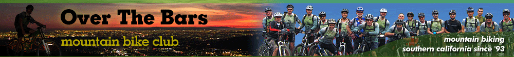
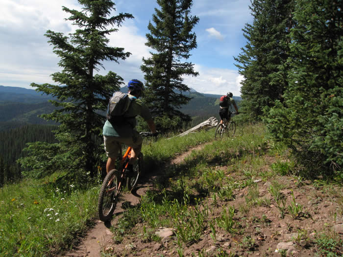
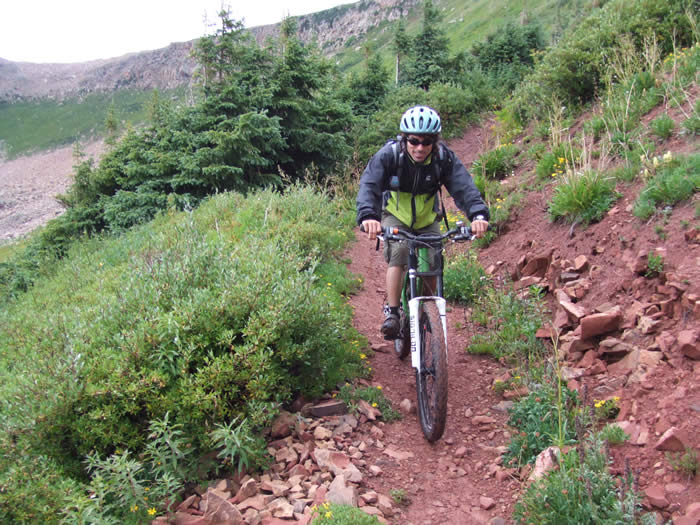
 The trail started out fairly easily. Level for the first mile, It was single track for the most part, which paralleled and criss-crossed an existing dirt road.
Much of the trail was on old logging roads, but nature was well along the way to reclaiming those logging roads, so that only a single track sliver of trail went down the middle of the levelled-out roadway.
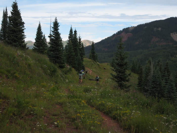
After the first mile of near level, rolling terrain, we climbed for a mile and half up to about 11,000'. From there we followed a ridgeline, weaving in and out of pine forests for much of the way.
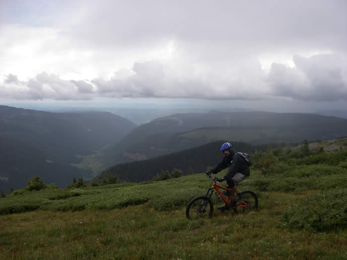
 We could see the valley floor below and to our east for much of it. The skies were overcast and grey, and we were enjoying the drier, cooler weather. A few times the sun came out and it warmed up quickly.
Along the ridge, the trail was exposed to the south and had a few short climbs, but nothing significant for several miles. Almost nine miles into the trail. It was fast in many sections with a slight downhill grade, and easy climbing.
As we did one climb at about 7 miles it started to rain. We stopped to put on rain gear, and waited a few minutes. The rain turned to hail, but then backed off after about 10 minutes. The clouds were darkening, and it looked like there was a row of dark clouds lined up and headed our direction. We pushed on. The trail cruised on and the rain turned to sprinkles, but the trail through this section had been muddied and looked like it had seen a lot more rain during the morning.
While we approached the next longer climb at about 11 miles, it started to rain again. The trail did some long switchbacks up the face of a hillside, but was entirely rideable. We cruised through the top, but Ed had to take care of more business, and caught Hans and Steve at the top. We climbed up to about 11,700' before the trail levelled off.
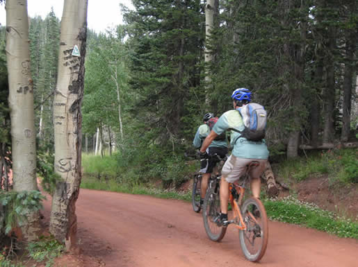
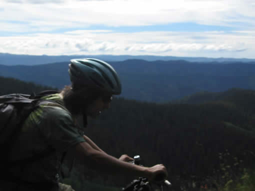
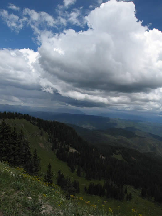
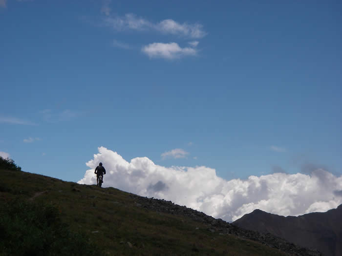
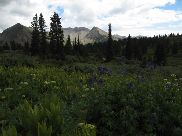
The views up here were fantastic. Mountain ranges and valleys as far as one could see, with a low-ceiling cloud cover keeping things cool.
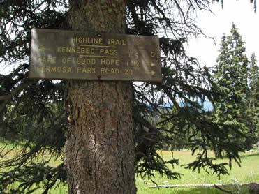 It was about now we heard our first rumbles of thunder. We knew the trail followed an exposed ridgeline at over 12,000' so lightning was fast becoming an issue. The trail here crosses and intersects lots of other trails and is very well signed. We crossed the Grindstone trail, Salt Creek Trail, Big Bend Trail, Corral Draw trail, and others. We were on the "Highline trail". The Colorado trail in many places follows networks of existing trails.
We had descended a little and had some more fun single track before the trail once again climbed. We reached treeline and with the rumbles of thunder, were a little nervous about the weather and building, darkening clouds.
.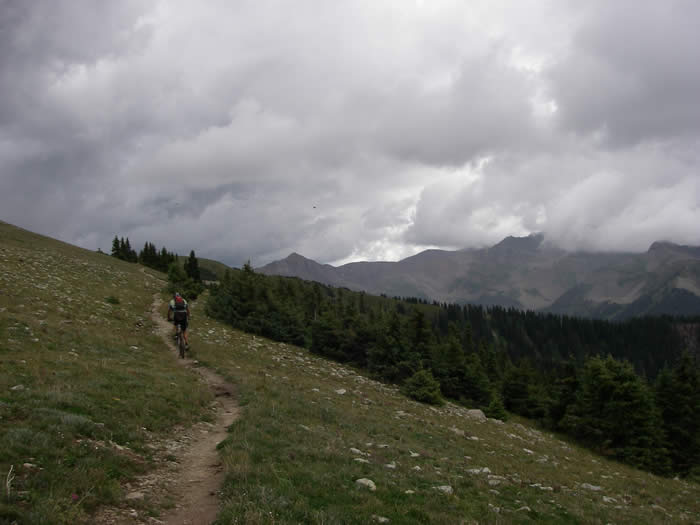
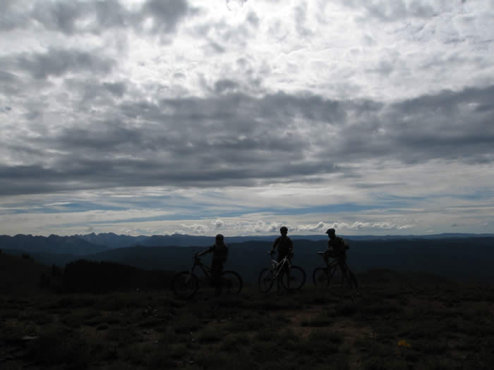
Now that we were on top of the ridge it was apparent that the wind was actually out of the west, though when on the east side of the ridge it felt like it was out of the east. This is a "wind rotor" where the wind goes over the ridge and feels like it's coming from the other direction. So the darkening clouds were not actually coming towards us, but were ortographic lifting from the westerly winds. Still a bit disconcerting. There was also lightning and thunder on the next mountain range over to our west, Snowstorm Peak.
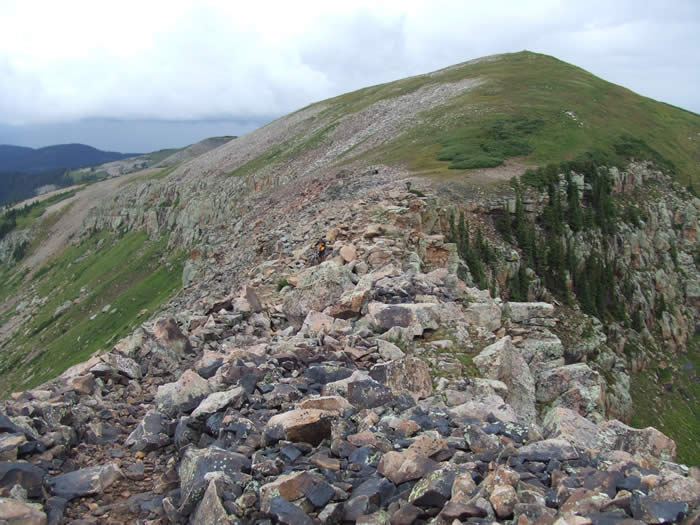
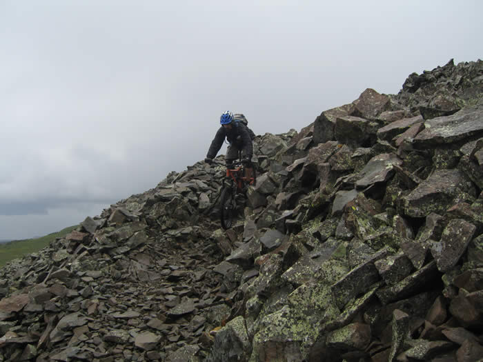
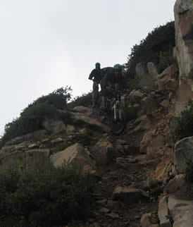
The climb became a rocky hike-a-bike.
The darkest clouds were to our east, and moving slowly away from us, but still sending sheets of rolling thunder overhead and around us, but as yet, no visible lightning flashes.
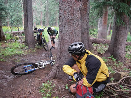
At 15 miles we saw a group of horses coming towards us on the ridge. They said we'd be hiking our bikes but the trail was good. We droppped down a little and began the next climb. There was a slight downhill at about 15.8 miles and Hans clipped a rock at high speed and broke his derailleur hanger (second time on the trip), and bent his derailleur.
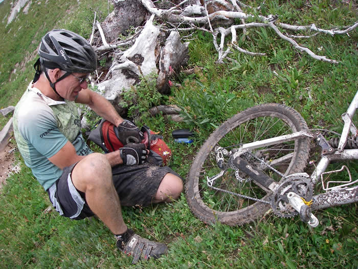
With his broken XO shifter, it was a problem. We were able to put on a new hanger (his last spare) and get it to stay in the second cog where he stayed for the rest of the ride. We were being rained on as we did the repair, and there was more rolling thunder. We were at just under 12,000' and still had a few climbs and descents, and two miles before reaching the peak of the trail at 12,310'.
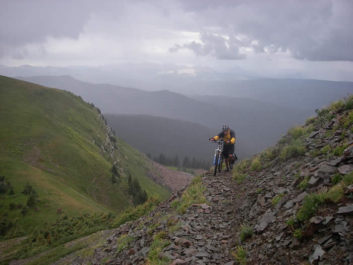
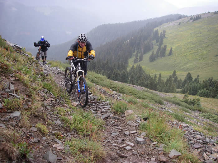
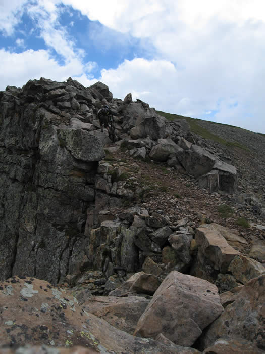
The next few climbs were all hike-a-bikes. They were rocky, muddy, and steep. They switchbacked up scree fields and we were exposed on the ridge.
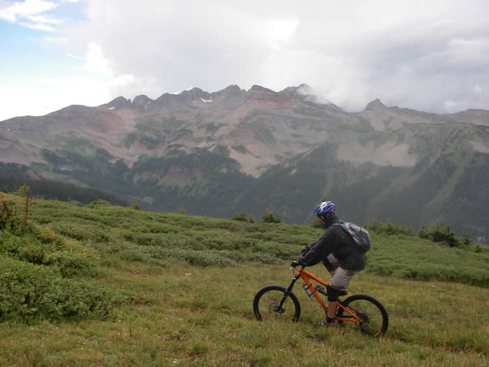
The views were incredible, but with the building thunder to our east, we weren't taking too much of the view in. We were looking more at the clouds and every time the thunder rumbled we'd slow down, and look around nervously. It was coming from the east, from the west, and occasionaly from overhead. But we hadn't seen any flashes of lightning, so the concensus was that we would continue. It was raining on and off lightly, but we could see clearer skies ahead, past the ridges over which we'd have to cross in the next few miles.
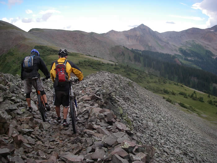
The second descent was all loose scree and rock, and was a challenge to ride. The rocks would move about constantly under the tires, making it a challenge, but really fun. We were riding along a ridge top and the trail descended to the other side. We could see the last climb ahead, another hike-a-bike to a ridge top, and another rocky descent down the back side of the ridge.
The final climb was another rocky one. Hans was first up, but didn't hang out at the top. We'd seen our first flash of lightning off to the east inside a particularly dark cloud. He dropped down to the saddle. Our guidebooks had shown a descent from here, but we were faced with yet another climb, even more difficult and rocky. It wasn't too long though, and the we got through it fast. The rain had stopped and we were feeling good about getting over the ridges without too much problem.
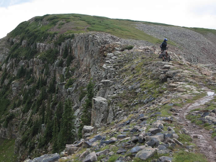
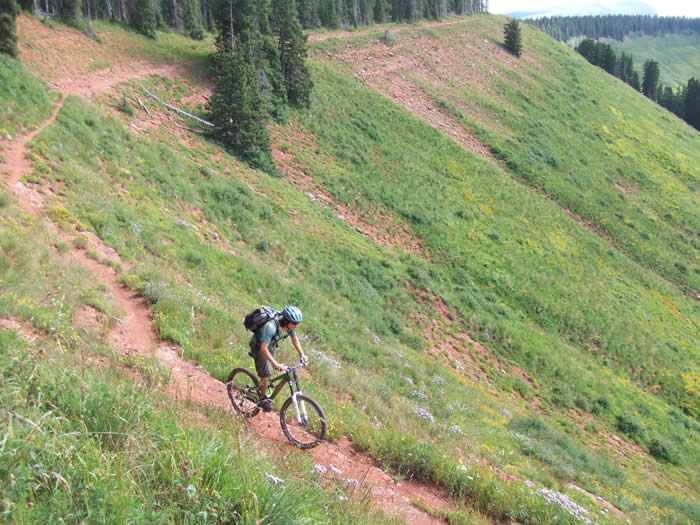
The final descent was extremely technical and rocky, with a big cliff exposure. It was reminiscent of sections of the Flying Monkey trail in Utah, though much shorter. Just three switchbacks and we were at the bottom, having dropped 600' in elevation in less than half a mile.
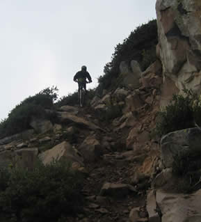

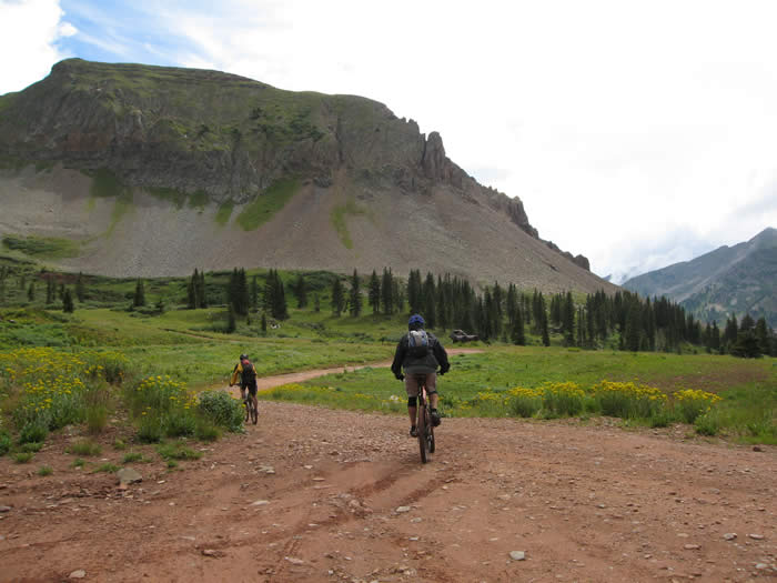
The technical section was fairly short, just a few switchbacks, then the trail smoothed out and got a little muddy.
From there we rolled out through fields of wildflowers, past a lake and on to the end of the segment.
We'd asked Phil to be there at 4:00 p..m. and it was now a quarter to. It was great that he wouldn't be waiting for hours like he did yesterday.
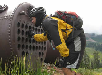
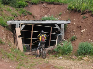
Not far down La Plata canyon road are the remains of the Cumberland silver mines. We stopped and checked them out, before heading down a steep, rocky four-wheel-drive trail for a few miles to meet Phil.
Phil was driving up the road as we reached 3.8 miles. We loaded up and headed into Durango for food and internet updates before heading back to camp. It had been a shorter day, 24.13 miles, 4:30 ride time with 6:30 on the trail, 4150' climbing and 6366 of descent. Only Hans' shifters and derailleur were problems.
Note: A good option here would be to stay on the trail for another four miles of downhill and then premitive camp at the location were we started day 21. This would avoid the long drive on the dirt road back to the trailhead.
© 1994-2014 Over the Bars Mountain Bike Club. All Rights Reserved