|
|
|
|
|
|
|
|
|
Colorado Trail MTB Bike Tour
Day 9 - Tennesse Pass, Leadville
July 29, 2006. Today began with the usual routine of breaking down camp, getting breakfast ready, and loading up for a ride. Hans, as usual, was up first and already had his gear packed when he woke everyone else up at about 6:00. He cooked an excellent egg breakfast (Andres' recipe!).
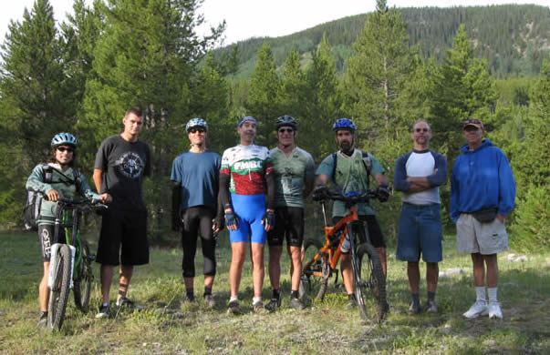
It was Mike and Glen's last night with us, and they left with Rooney's car and Phil in Ed's truck to head back to Denver airport for the flight back to California. We said our goodbyes to them, and headed out with our new riding partners, Bill and Rooney.
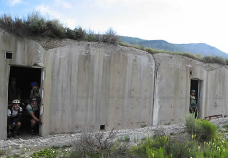
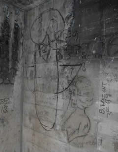
We left the camp hale campground at around 7:30 in the morning. We cruised back by the bunkers, and went inside a few of them. They were like graffiti art galleries, their role in history now just a memory.... There was a group of good ol' boys shooting automatic rifles down near the bunkers. Somehow it didn't seem out of place.
The trail began by crossing a bridge, then climbed. It was a good climb at first, quite steep in a few places but mostly rideable. Rooney powered up most of it like he'd been at altitude all along. He had fresh legs, and this wasn't very high, only 9500' elevation.
We climbed for a good 30 minutes, then received a call. Glen had been unable to find the dropoff point for Ed's truck, even though it was programmed into Hans' GPS with driving directions, and it was on the same road they were on. Instead we had them drive to Leadville, and leave the truck there.
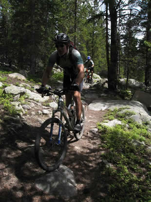
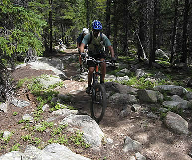
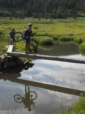 We continued on the trail, grunting up some rocky sections that we were able to clean. Bill chose to walk a few, as the rough trail was hard on his neck and shoulders. But it was well worth it. We emerged on Highway 24, and crossed the highway. There was a railroad track we had to cross, but it appeared that no trains had run on it in some time, because of the rust on the tracks. The trail went across a meadow, then a bridge, before climbing once again.
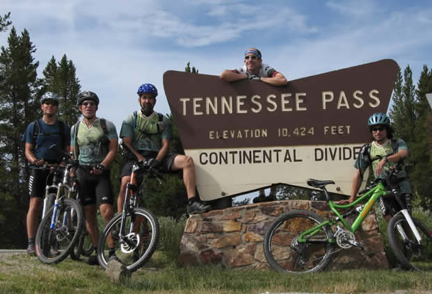
The trail wound it's way through a meadow, then began another gentle climb. Eventually it reached a fire road, which went past some old charcoal kilns, and eventually out to Tennessee Pass and Highway 24.
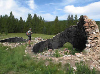
At the pass there is a memorial to the WWII troops who had trained at Camp Hale, where we'd camped. We took a short break there, and headed back on to the Colorado Trail, which for this section is also the Great Divide Trail.
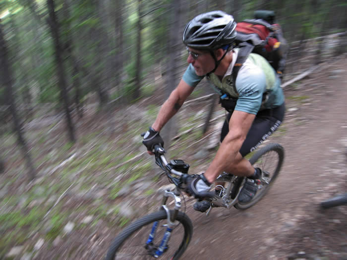
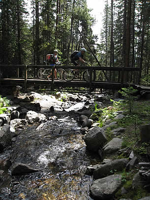
Again the trail climbed, and again it was rocky and technical. It was difficult in places, but still mostly rideable. It rolled up and down, wound its way through the pines, got rough, got smooth, crossed creeks and bridges. It was really fun, and again kept us on our technical toes.

Our plan was to cut down from the trail just before reaching the wilderness, onto Long Gulch jeep trail, which would take us back out to a dirt road by a lake, and on to the highway, where we were supposed to pick up Ed's truck and head on to the next segment on the itinerary, Segment 11.
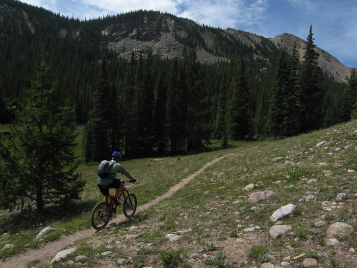
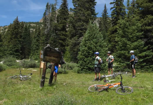
We made it all the way to the wilderness boundary, we stopped and took a break. A group of about 8 hikers came out of the Mount Massive wilderness and we chatted for a few minutes. They said the first few hundred yards of the wilderness portion of the trail would be great, but after that we'd probably be pushing our bikes. Steve left a message in the wilderness sign-in book, voicing our opinions...
We hadn't seen any side trails coming off the Colorado Trail, and had missed our turn-off to head out to the highway. Using the maps and the pages of the guidebook we'd torn out and brought with us, we tried to figure out where that trail might be. Steve programmed the location into his GPS, and we headed back out and found it. The jeep trail that we were looking for stopped about 100 yards short of the Colorado trail, and there were just a few poorly defined tracks, but no trail, leading from the Colorado to it. Without the GPS we probably wouldn't have found it.
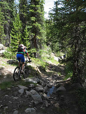 The Long Gulch jeep trail was rough... not a fire road, but a true four-wheel-drive trail with rocks, mud crossings, steep sections and in many places was hard to distinguish from the surrounding forest floor. It was a fun descent, dropping a good 600 feet or so in a few miles before merging with County Road 21.

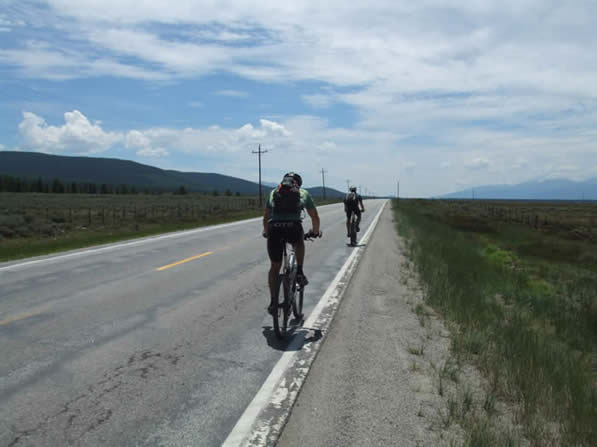
We headed right at County Road 21, passed by a lake with lots of cabins around it, passed a fishing club, and out to the highway. The road was clearly marked, but we had to ride in to Leadville to pick up the truck.
It was strange riding on a highway after 160 miles on single track in the past week. The road had a slight grade, and by the time we got to Leadville, we were pretty worked. The rocks and roughness of the trail was physically demanding, especially at nearly 11,000' elevation. We opted to eat lunch in Leadville, and camp at the trailhead for the next section.
We made it out to Half Moon campground, and circled around looking for a site. Being a Saturday, most of the campground was full, but we lucked out and found somewhere nice, across the road from a creek, and nestled amongst the pines.
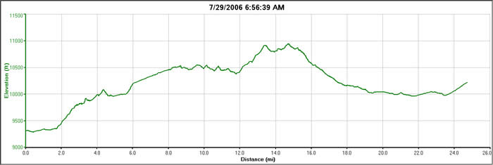
The day hadn't gone according to the original plan, but was still an epic day of riding. To be able to clean rough technical sections while climbing at altitude was pretty rewarding. We didn't go over any spectalular passes; Tennesse pass itself is just 10,424' and Highway 24 passes right through.
It was a 24.4 mile day, with about 2500' of climbing and a maximum elevation of 10,950.
© 1994-2014 Over the Bars Mountain Bike Club. All Rights Reserved